
The Planning Division is involved in many different planning initiatives throughout the City, including area master plans, redevelopment plans, corridor plans, and the City-wide comprehensive plan. An important part of the planning process is public participation; click on the links below to get more information and to find out how you can get involved in the planning and implementation for the plans below. Please note that some of the plans below represent joint planning efforts with Richland County, such as the Walkable 29203 Pedestrian Master Plan and the Capital City Mill District Area and Corridor Plan.
Plans In Process
We’re currently working on a strategic plan for Downtown Columbia!
You can also check out our existing area plans below, and sign up for our newsletter to stay engaged with Columbia Compass, our comprehensive plan.
Adopted City-wide Plans
- Columbia Compass: Envision 2036 (Comprehensive Plan)
- City-wide Architectural Survey & Historic Preservation Plan (1993 Bryan Survey)
- Public Space Public Life Action Plan (2016)
- Walk Bike Columbia Pedestrian & Bicycle Master Plan and Bike Share Plan (2015) (additional information is available here)
Neighborhood, Area, and Corridor Plans & Historic Surveys
The City has a rich history of planning for neighborhoods, areas, and corridors. Plans developed in recent years are linked below; historic plans for the City and its neighborhoods are available for viewing in the Planning Division’s offices, through the Central Midlands Council of Governments, and Richland Library.
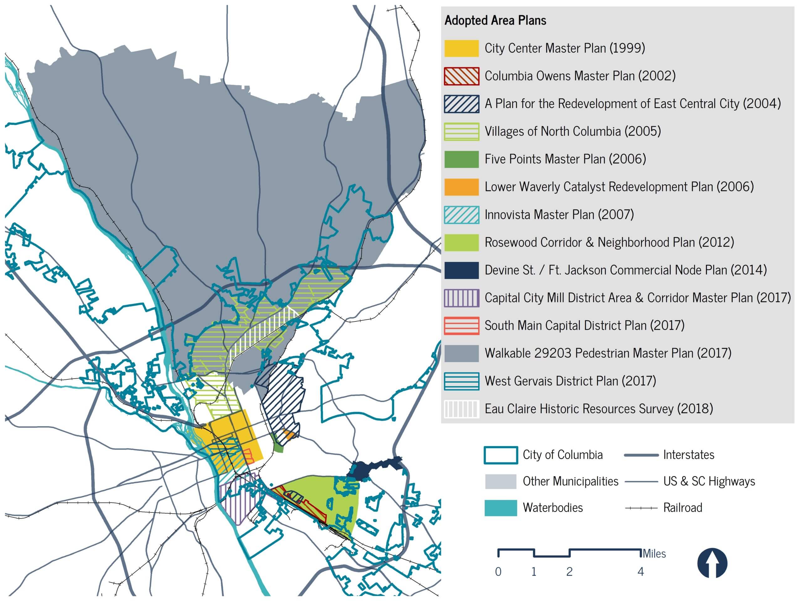
Area Plans – City of Columbia (click to enlarge)
- A Plan For the Redevelopment of East Central City (2004)
- Capital City Mill District Area and Corridor Plan (2017)
- Catalyst for Columbia: The Impacts of Historic Preservation in Columbia, South Carolina (2023)
- City Center Master Plan (1999)
- Columbia Owens Master Plan (Click here for Executive Summary Only) (2002)
- Devine Street – Fort Jackson Boulevard Commercial Node Plan (2014)
- Downtown Historic Resource Survey (2020)
- Eau Claire Historic Resources Survey (2018)
- Future Five: Five Points Master Plan (2006)
- Innovista Master Plan (2007)
- Lower Waverly Catalyst Redevelopment Plan (2006)
- Master Plan for the Villages of North Columbia (2005)
- Introduction + Executive Summary (Section 1)
- Community Analysis (Section 2)
- Master Plan (Section 3)
- Catalysts (Section 4)
- Action Plan (Section 5)
- Rosewood Corridor & Neighborhood Plan (2012)
- South Main Capital District Area Plan (2017)
- Walkable 29203 Pedestrian Master Plan (2017)
- West Gervais District Plan (2017)
Progress Reports
Moving forward a recommendation of Columbia Compass, we’re working to provide updates on plan implementation. This reporting is critical for a number of reasons, including:
- Reporting keeps us all accountable. Plans are community-driven by their very nature, and implementation of plan recommendations requires continued stakeholder collaboration.
- Reporting helps us identify and celebrate successes, linking them to the planning process. Implementation after plan adoption is rarely immediate, and linking back to the planning process as recommendations become reality helps inspire community engagement in future planning processes.
- Reporting helps us re-evaluate. In reviewing each plan’s progress, we better understand what has been completed, what still needs to be done, and sometimes, what might no longer be relevant to achieving the community’s overall vision.
Future Planning Areas
Columbia Compass identifies areas for future neighborhood, area, and corridor planning efforts. A number of the areas identified represent joint planning areas, where multiple jurisdictions work together to best plan for a community.
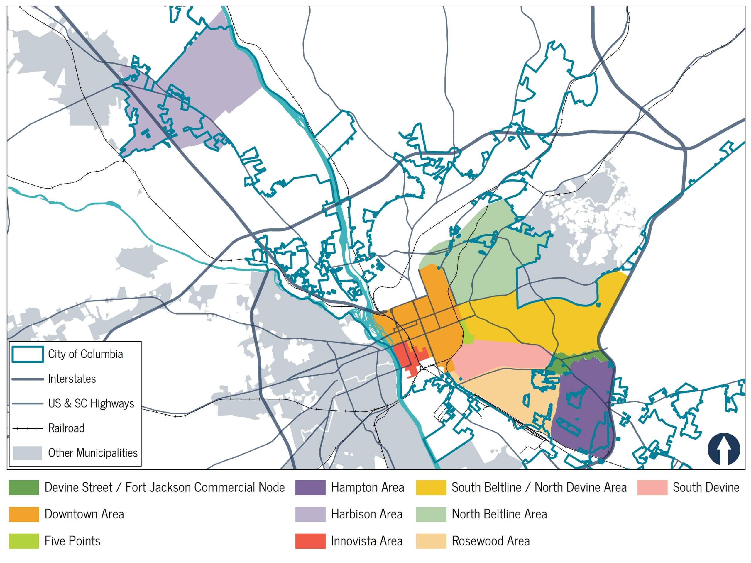
Future Planning Areas – City of Columbia (click to enlarge)
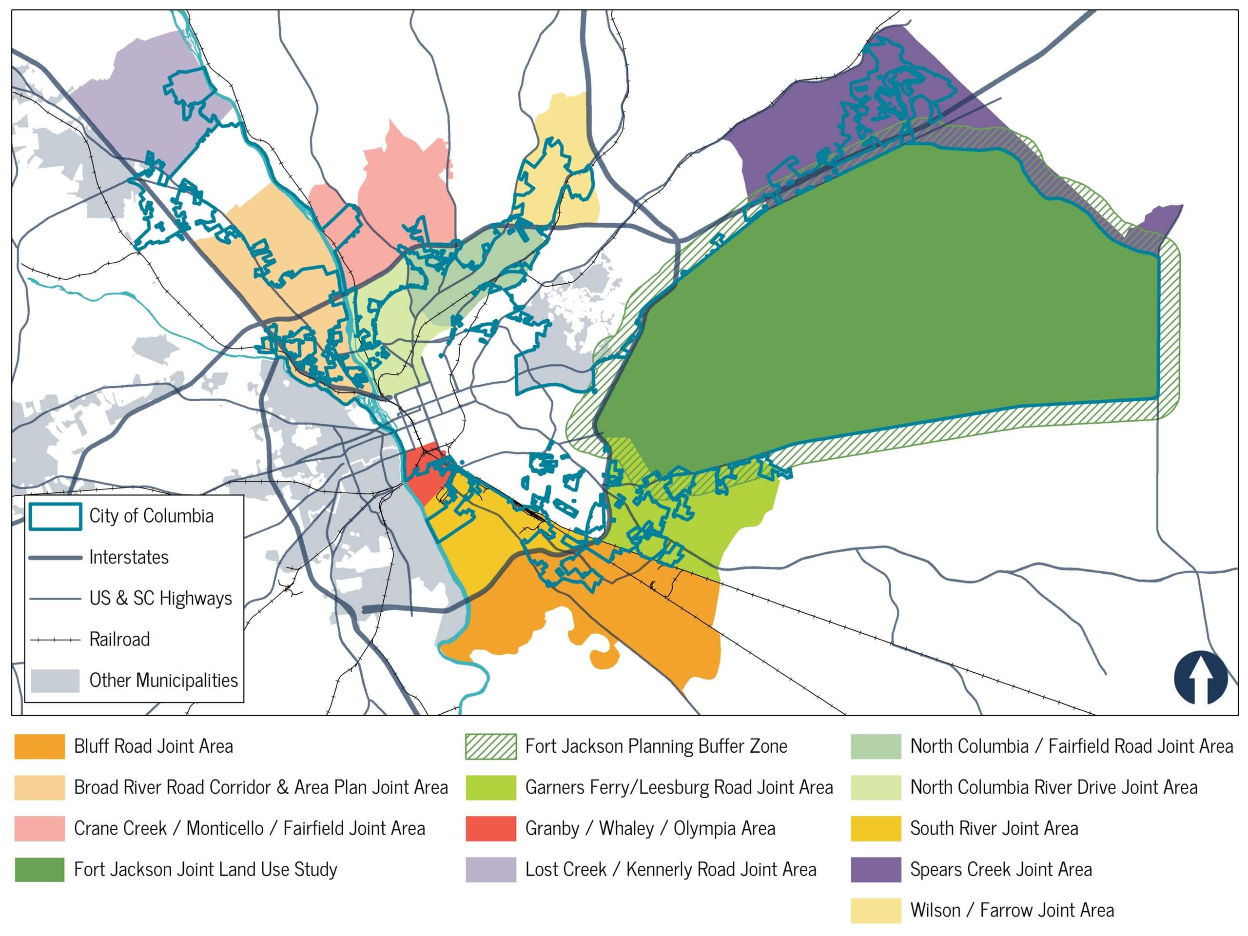
Future Joint Planning Areas (click to enlarge)
If you have further questions, or would like to more information about City plans, please contact us.