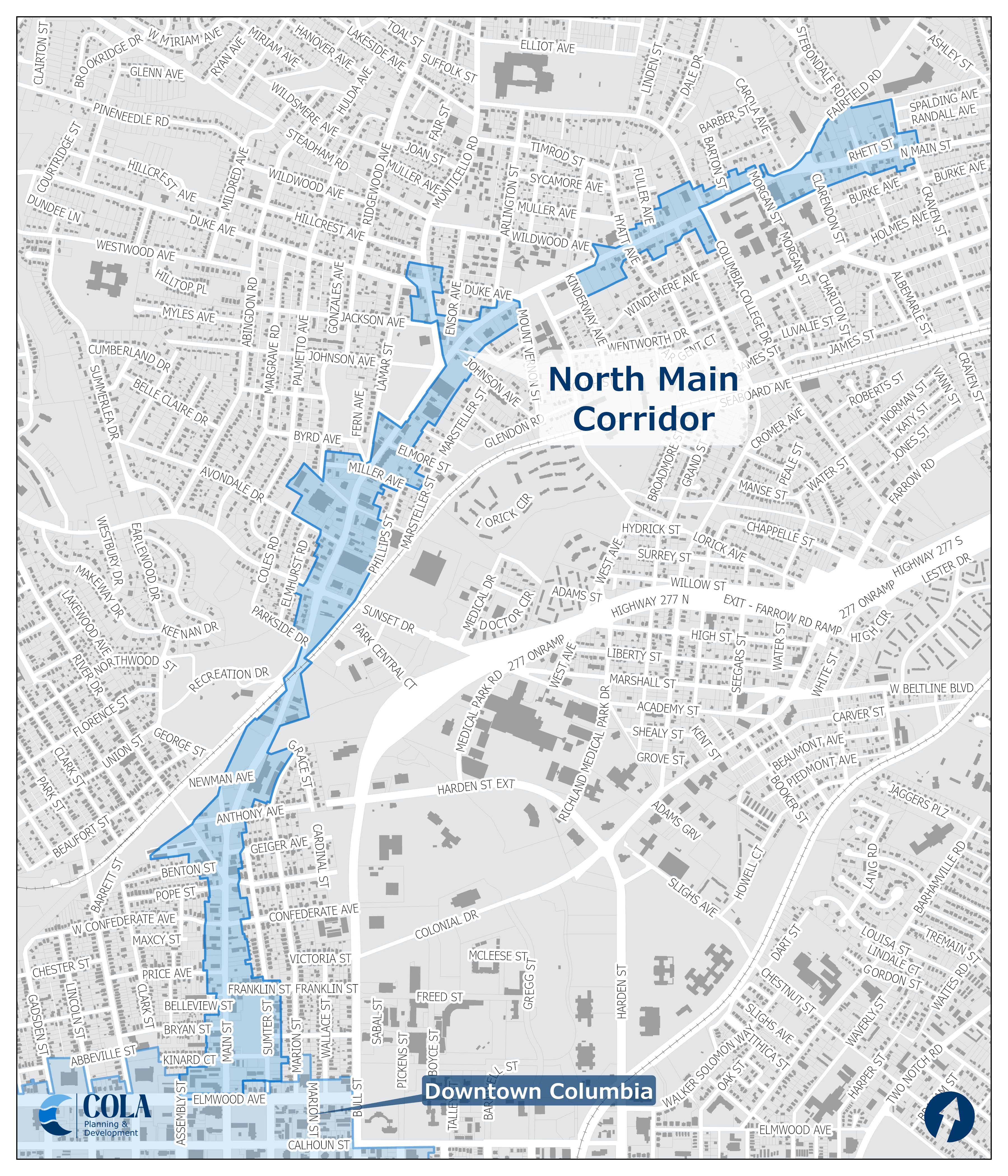
North Main Corridor Design Overlay District
Initiated by the Master Plan for the Villages of North Columbia, and following on the heels of the North Main Street right-of-way improvements project, the North Main Corridor is the first portion of the land use implementation process to take place. The process was essentially to review the goals and objectives of the master plan, assess the inconsistencies in the current land use regulations, and to propose new land use regulations that would remove obstacles and create incentives for the types of development called for in the master plan for the North Main Street corridor.
Thorough public input sessions with property owners and stakeholders were held to develop the proposal and adjust as needed to respond to concerns. Implementation of the plan included a rezoning of parcels along the corridor, and affixing the design overlay district (OV-NMC).
Not sure if your property is within a Design Overlay District? Check out the City Information Viewer Interactive Online Map.
Questions? Contact our Urban Design staff.